|
|
 |
Accessing EO Data |
|
|
|
How to Apply |
|
|
|
How to Access |
|
| |
|
|
|
|
|
|
 |
EOLI-SA |
|
|
|
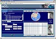
The EOLI-SA (Stand Alone) client
combines the advantages of both the online and offline
catalogues. This tool provides access to the online ESA
catalogues of Earth Observation (EO) products. It allows
the visualisation of quick-looks and the online ordering
of EO products.
A copy of the inventory can be
downloaded locally to increase response times and to
perform interferometric searches on Envisat and ERS SAR
products. The tool gives access to all collections for
which ESA provides products.
EOLI-SA is a java
application supported on all major patforms (Windows
95/98/ME/2000/NT/XP, Linux, Solaris, Mac OS X and other
Unix systems). |
| |
|
|
|
|
|
|
New
EOLI Web client |
|
|
|
The new EOLI Web Client client
provides access to online ESA catalogues of EO products
via a standard web browser, as well as to the catalogues
of other data providers (for example DLR) and is part of
ESA's eoPortal. This tool doesn't allow online ordering
(for which we recommend to use EOLI-SA), but it allows
you to browse the meta data and obtain further
information about the collections and products available
from ESA and other providers. |
| |
|
|
|
|
DESCW |
|
|
|
DESCW is an offline multimission
catalogue covering ERS, Envisat and ESA Third Party
missions. It is a tool providing users with the
information about satellite/sensor data availability for
a given time interval and over a specified geographical
location. Orders for products can be formulated using
DESCW. Regular updates of the data for use within DESCW
are available via FTP. |
| |
|
|
|
|
IONIA |
|
|
|
The IONIA server allows access to
the Level 3 Earth Observation Products generated at
ESA/ESRIN from ERS and other sources. Ionia is the name
of the Greek school of philosophy (VI-V th century BC)
that formulated the theory of the cosmos as constituted
by four basic elements (fire, water, air, earth), the
same elements that are now observed from space-born
instruments and constitute the main fields of interest
in the analysis of remote sensing images. |
| |
|
|
|
|
ATSR Global Fire Atlas |
|
|
|
The ATSR Global Fire Atlas
provides monthly global fire maps made from ATSR-2 night
time data. The maps are generated monthly, and cover the
period from September 1995. |
| |
|
|
 |
|
|
|
 |
ATSR ASST | |
|
|
|
|
|
eoPortal | |
|
|
|
|
|
ESOV Classic | |
|
|
|
|
|
CERSAT Catalogues | |
|
|
|
|
|
GOME Fast Delivery
Service | |
|
|
|
|
|
N-GONG | |
|
|
| |
|
| |
|
| |